It's been a while since we updated our blog but wifi/4G is incredibly difficult to come by this far out. Since we last updated you we've gone maybe 150 miles or so. We are currently at the home of Linda Taylor watching movies and generally laying around near Rangely Maine. It is hard for us to believe but we are 34 miles away from being 2000 milers!
After Hanover we had some reasonable terrain and continued mud. We came across one final and excellent iteration of Wingmom trail magic by the first grassy field in weeks. We pushed on to the Glencliff Hiker hostel in New Hampshire before starting the White Mountains which are the scariest part of the trail. The ups are the longest and steepest of the trail, incredibly rocky, and often above treeline. After doing Moosiluake and Kinsman mountains we stopped in a little known (which actually means nicer) hostel in Lincoln before starting the really difficult and gorgeous parts of the whites.
We started over Franconia ridge. I got exactly 0 views but Garfunkel, only 5 or 10 minutes behind me, got incredible views as the clouds passed away. We then hiked over Garfield (the hike down is literally a waterfall) and had lunch at one of the best spots on the trail.
Through the whites there are few shelters and campsites but there are a system of huts maintained by the Appalachian Mountain Club (AMC). The huts are large lodges run by croos ( the spelling is correct) of kids our age who cook and run the hut. A few thru hikers are allowed to stay at each hut every night and ear left overs in exchange for an hour or so of work. We stayed at Mizpah, Madison, and Carter Notch huts in exchange for scrubbing floors, scouring greasy dishes, and cleaning a dank basement. I had heard the hut system can be terrible for some hikers but we think they were one of the best parts if our hike so far. The croos were awesome due in no small part to them playing settlers of Catan with us at Mizpah and Carter.
After a few idyllic days the rain came so we had no views on Washington or after in the whites. Since most of the trail in rocky and steep I also took 5 or 6 nice falls. The hiking through the Whites as fellow hiker Oz describes it, is as close to rock climbing as you can get and still call it hiking.
We zeroed at the White Mountains Hostel and Lodge in Gorham as we hadn't in ages and it was the nicest hostel we've come across. Here we parted ways perhaps for the last time with longtime trail friend Sandman. We hiked with him through most of the Whites but he recently got off for a wedding so we likely will not see him again. We also ran into Oz, Patch, and Sophie again whom we haven't seen since heading up Franconia. We got a little separated but will likely meet up with them again in the next day or two.
After Gorham we started the Mahoosuc range and entered Maine. The Mahoosucs were just as hard as the whites with intense rock scrambles up and downhill and many spots with rebar drilled into the rock to help us. Our pace really dropped here (2 10 mile days). The weather did clear up and has been hot ever since so we've been swimming a few times. We also did the Mahoosuc Notch which is the hardest mile of the AT. It is all boulders you must go over and under. The notch is so rocky and steep under most boulders ice and snow was still hanging around on a 90 degree day in July. The guy in the later pictures is Carjacker, who we've been hiking with since we left Gorham.
Cairns mark the AT above treeline
Moosilauke on July 4th with patch, Sophie, Oz, and Garfunkel
The trail straight down next to a waterfall
On top of South Twin Mountain
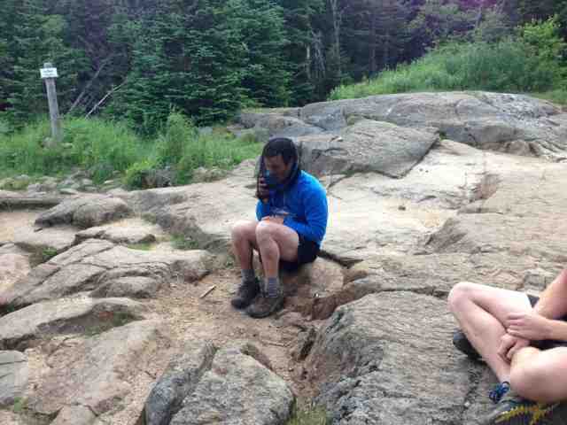
Sandman eating in a bug net to avoid the swarms
Being
above a massive raincloud at Madison hut, a severe undercast
Lefty and Hush, the flip flop honeymooners. We've been hiking with then for a couple days after following them in the registers for 100s or miles.
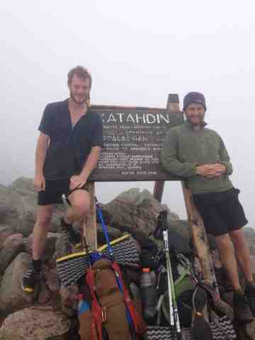
This could possibly be the final blog update until Katahdin! ( we'll try for one more before summit pictures though)